


There are no Red or Blue States.
There's not even Purple states. So what IS there?

This should be obvious to all but the most glaring partisan or most hopeless idiot. The states of the nation itself, despite what election maps lead you to believe, are NOT red or blue.

Oh, I get WHY people believe this. We have a huge problem in this country, of believing in the Faulty Binary. Our elections are (for the most part) Winner-Take-All - and so is the way we think about the world. You are either for us or you are against us. You are either Of Jesus or Of Satan. You are either Coke or you are Pepsi.
This kind of thinking is what left conservative Arizonans to believe that they were forever a ‘deeply red state’ - despite having voted almost 50-to-50 Republican to Democrat for the past several elections - and then being shocked to their core and only able to sputter ‘conspiracy!’ when their state flipped.
Because of course, states are made of counties, and counties each vote differently:
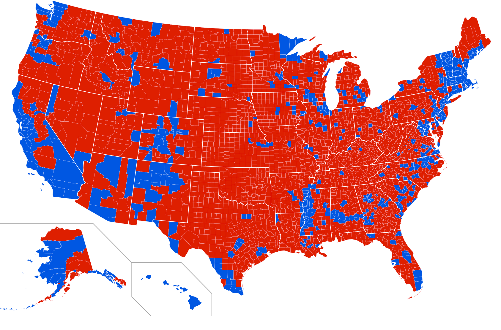
But this map, too, is deceiving for a few reasons. The average American seeing all this red might conclude ‘oh wow, this is a solidly Republican nation!’ Especially if they’ve not traveled much, and have just assumed the rest of the country looks more or less like their little town.
What is not obvious on here is, of course, population. It’s a cliche, but land doesn’t vote, people do. Those little blue dots amidst the sea of red? Those represent almost every one of America’s 100 biggest cities, and well over half of America’s population.
It would be far more accurate to say we have Red Countryside and Blue Cities. And that’s a bigger issue that no red/blue state secession can solve.
But of course, even in New York City, millions voted for Donald Trump. And even in the most partisan of states (Red Wyoming and Blue Vermont), Biden and Trump respectively won 1 out of every 4 voters.
We’re all purple.
Here is a slightly more nuanced portrayal of the 2020 election on the state level, courtesy of the Purple States of America project.

So, while several states can make a claim to be Majority Red or Majority Blue, the only ones that could remotely be considered Supermajority States (i.e. 2/3rds of the population votes in one direction) would be Wyoming, West Virginia, Maryland, Vermont, and maybe Oklahoma, Massachusetts and North Dakota.
Here is an even more accurate county-level map of our national purpling:
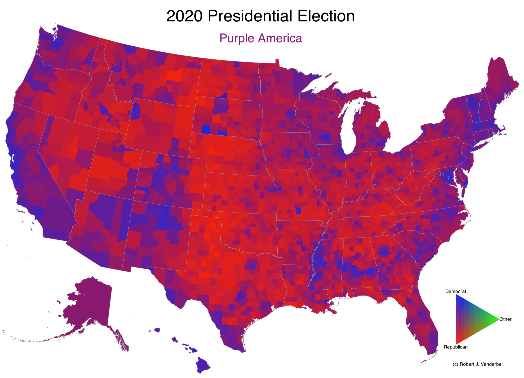
Again at the county level, we can see that - with some areas of stark exception - huge swaths of the country are actually split fairly evenly between Republican and Democrat. The Eastern Seaboard, Front Range and Midwest are particularly purple, a representation perhaps of suburban sprawl beginning to eat at the edges of both the big liberal cities and the rolling red country.
But here is my favorite map, from Princeton’s Robert Vanderbei. On this, each ‘tower’ represents a county’s population.
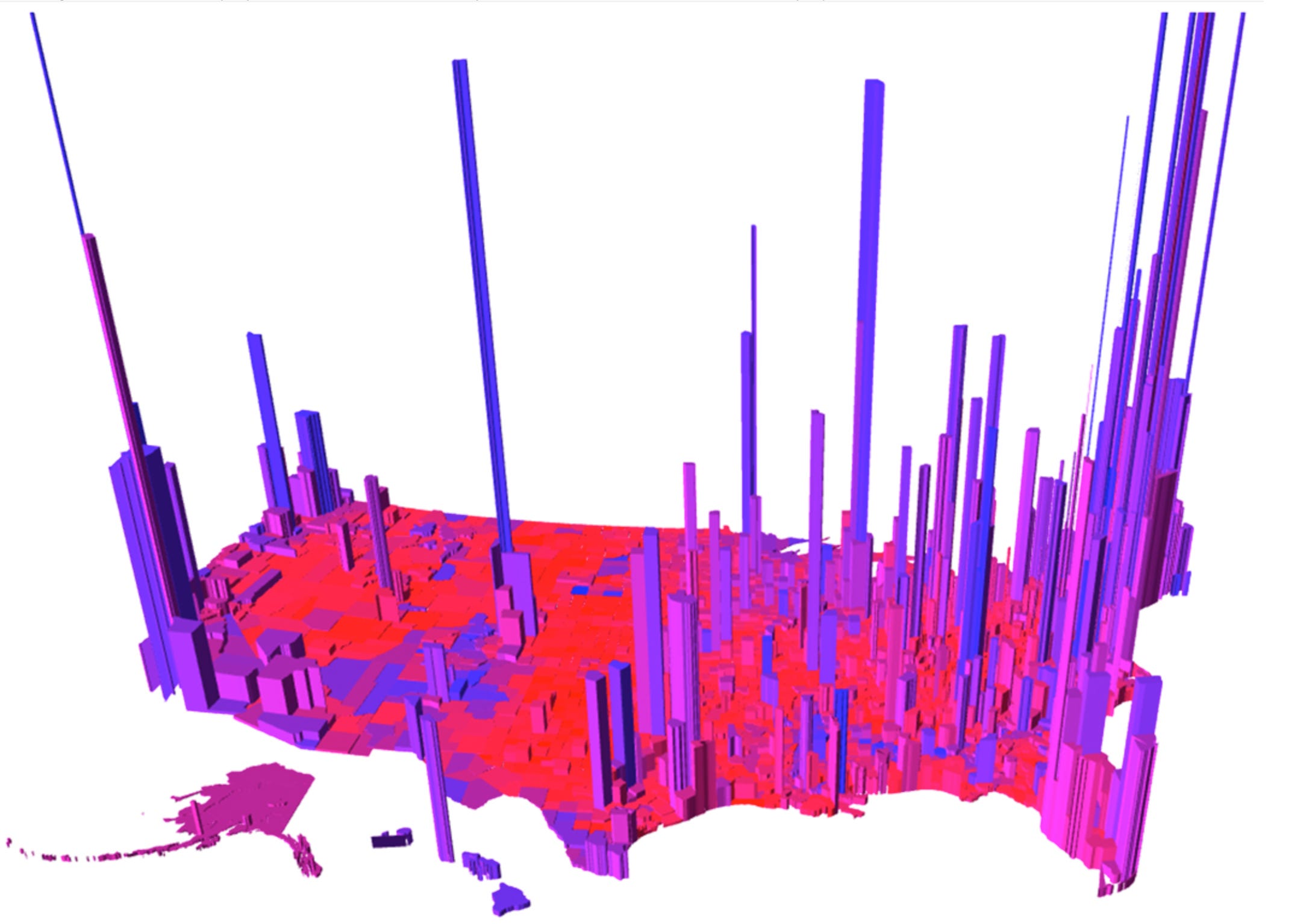
Despite being impossible to parse in the clustered areas, I think this is overall extremely clear:
The sparsely populated parts of our nation are almost by default Republican (with the notable exception of the rural Black counties of the Southeast, and the Native reservations).
Our medium sized cities, and the suburbs around them, are very purple; they trend slightly more Democratic in the north and Republican in the south.
Our big cities are categorically Democratic.
And that’s it. The state borders are almost completely arbitrary at this point; these are the true dynamics of American voting in the 21st Century.
National elections are now won at the margins, due to the arbitrary nature of current state borders, their concomitant electoral vote distributions, and the “winner take all” system. Thus, any flip of a state should reasonably be seen NOT as a “party mandate” or “red/blue wave” - but as a bug due either to minor ripples of mood (Georgia and Arizona going blue in 2020, or the Rust Belt going Trump in 2016), or demographic shifts in a state itself (more Republicans moving to Florida).
So, the next time a partisan tells you that the red and blue states should split up, just point them here, and see if they can still defend their assumptions. I’d love to hear from them if they can!